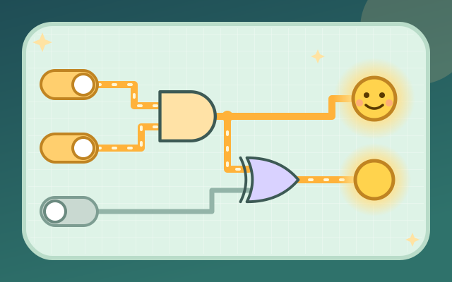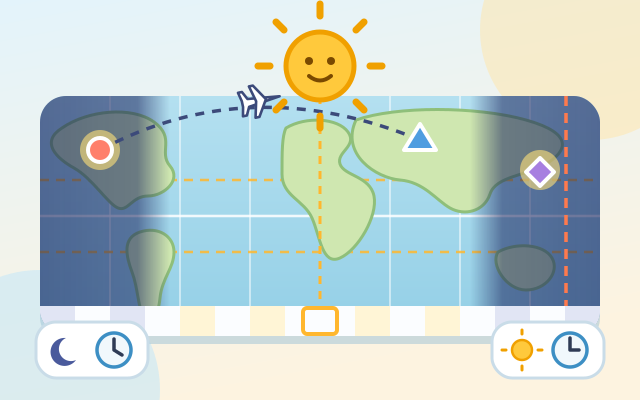
An observation-and-reasoning game about the Earth's rotation, longitude and time zones. The screen is a world map with the sun fixed above its middle while the Earth turns from west to east: drag the map to the right and time moves forward. Under the sun it is noon, at both edges midnight, and the night half darkens as city lights come on. A strip under the map marks one time zone for every 15° of longitude, and city cards show the local time and whether it is day or night (sun and moon icons), and in later chapters the date and the hours of daylight.
There are 5 chapters and 30 levels: Day and night (make it exactly noon in London, tap every city in daylight), Time zones (from Taipei time work out Tokyo and London; some clocks are hidden and must be worked out from the zone; find a video-call time that suits two cities), The date line (which cities are already on tomorrow? Fiji and Pago Pago are a day apart at the same moment; put the whole world on one date), Overhead sun and day length (drag the sun to change the month: sunshine straight down on the Tropic of Cancer, equal day and night everywhere, the midnight sun and polar night in the Arctic) and Flights across zones (add the flight time to the local departure time to get the local arrival time and date, and work back to a departure time). Random practice never runs out.
The game uses ideal time zones of 15° each and only real cities whose standard time matches them, with no daylight saving time. Real borders bend along countries (all of China uses UTC+8, India UTC+5:30), as the fact cards explain.
How to play
- Press "Start observing" to carry on from the first level you haven't cleared, or pick a chapter from "Levels". The first time you open a chapter, a field note explains its idea with a small picture; "Field notes" on the title screen lets you read them again.
- Turn levels: read the task (for example "Make it exactly noon (12:00) in London"), drag the map sideways or use ‹ ›, watch the times on the city cards change, then press Check. Pick levels: the map stops at one moment; tap every city that fits (tap again to undo), then press Check. Question levels: turn the Earth to help you think if you like, then tap an answer card. The clock of the city being asked about stays hidden until you answer correctly.
- Chapter 4: drag the sun up or down. It stops at 7 month positions (June over the Tropic of Cancer, March and September over the equator, December over the Tropic of Capricorn), and the city cards show the hours of daylight.
- Right first time earns 3 stars, one wrong try 2, and more still clears the level with 1. A hint caps the level at 2 stars. A wrong answer explains what is off (for example "It is 10:00 in London now") and you can try again at once. Clearing 3 levels of a chapter opens the next one.
Controls
- Phone / tablet: drag the map sideways to spin the Earth (each time-zone cell is one hour, and it snaps to the hour when you let go), or use ‹ › beside the world clock. In chapter 4, drag the sun up or down (or use ▲ ▼) to change the month. Tap a city card or its mark on the map to choose it, then press Check; in question levels just tap an answer card. The light bulb at the top right gives a hint.
- Mouse: press and drag on the map; everything else is a click, as with touch.
- Keyboard: ← → turn the Earth one hour, ↑ ↓ move the sun, Enter or Space checks, 1–6 pick a city (1–4 pick an answer), H hint, M mute, Esc goes back or closes a window.
For parents
- Made mainly for teens, and 9–12-year-olds can start with Chapter 1. It covers the Earth topics of secondary-school geography and science: rotation and day and night, longitude and time zones (15° per hour, UTC), working out time differences, the date line and dates, how the tilted axis moves the overhead sun (the tropics, the equinoxes), latitude and day length, polar day and night, and converting times when travelling across zones.
- A good conversation starter: why might we be asleep when family or friends abroad call? Why is jet lag often worse after flying east? The time zones are a simplified ideal model with no daylight saving time, and day length ignores atmospheric refraction; the fact cards point out how the real world differs. There is no timer. A wrong answer only explains what is off, and you can retry as often as you like. Cities are matched to their cards by shape marks (circle, triangle, square, diamond, star, heart), and day and night are shown with sun and moon icons, so nothing depends on color.
- No chat, in-app purchases, ads, outbound links or online leaderboards, and no personal details are ever asked for. Stars, seen notes, the number of practice rounds done and the mute setting are stored only in this device's browser, and the game also works offline.